Yesterday after sending the last emails I finally headed in direction of Amincha and the place where RocketGeronimo had let some water for me with a beautifull weather!
Amincha is the rest of the pueblo from the time people were needing sulfure from the mountain Aucanquilcha. There is a few people living there, most left to Ollagüe or somewhere else. Even Ollagüe suffers from the crash of sulfur in the world. That serious problem is the same for the production saltpetre which were as well used for black powder production. Ollagüe was a little bit more lucky as it is -for now- used as transfer (cargo and people) to Bolivia.
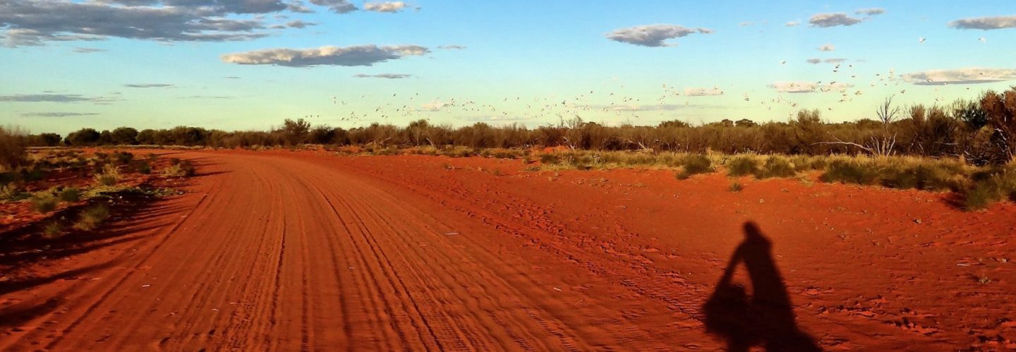
So I pedalled through that nearly dead pueblo, where at least one old women was living with her dog, as I saw them just before the entrance. Unfortunately, she was in the mood to talk while I wanted to go on. So after some polite words (last year as well as that year it rains not much: that was a good news for my project – sorry) I continued my way. It seems there was hundreds of people living here, just by the number of houses or offices. Even the train was coming directly from Ollagüe to Amincha.
Already from quite far you see something like a power line. After few 100 meters from the pueblo, I started to think it could not be possible…and it was not a power line but a cable car installation. Like we have in the alps for skiing, here it was to transport the rocks containing sulfure.
So the road started to go up and my legs in combination with food and water for several days to burn Then ground changed, I had to push. So I pushed to Gérards water station and then to the first “basecamp” at 4400m. I wanted to be as high enough and still having contact to the cellphone net of Ollagüe. For the one it is “addiction to cellphone” for others it is just great love to a person you want to be as long in contact as possible. There were quite much clouds… I thought their Bolivian winter would stop in March??
So today when I woke up, the program was quite obvious: reach base camp two between 5000 and 5100 meters. By the way, abundant vegetation stops here on that mountain at about 4800, the heigth of Mt-Blanc.
I had the information from several people that the body do not regenere itself at an altitude higher than 5100m. On the other hand, I wanted to be as close as possible to the mountain, to avoid long travel distance when aclimating myself to the altitude.
Arriving at 4950m, I found a quite good place which was still 3-4km away. I had time so I decided to see what were next. And it was a good training as it was said that one should always go a little bit higher then the resting place. And at 5090m, just below the road, I found what I was looking for:
1) not seen from the road
2) plane, I don’t like to sleep on a pent
3) good altitude
4) not risky regarding storm or strong rain.
So after building the tent I though again about the “rule” and decided to explore just a few hundred meters of higher altitude and to see if I could find the other way “out” (or north) I had seen on google earth.
Amincha is the rest of the pueblo from the time people were needing sulfure from the mountain Aucanquilcha. There is a few people living there, most left to Ollagüe or somewhere else. Even Ollagüe suffers from the crash of sulfur in the world. That serious problem is the same for the production saltpetre which were as well used for black powder production. Ollagüe was a little bit more lucky as it is -for now- used as transfer (cargo and people) to Bolivia.
So I pedalled through that nearly dead pueblo, where at least one old women was living with her dog, as I saw them just before the entrance. Unfortunately, she was in the mood to talk while I wanted to go on. So after some polite words (last year as well as that year it rains not much: that was a good news for my project – sorry) I continued my way. It seems there was hundreds of people living here, just by the number of houses or offices. Even the train was coming directly from Ollagüe to Amincha.
Already from quite far you see something like a power line. After few 100 meters from the pueblo, I started to think it could not be possible…and it was not a power line but a cable car installation. Like we have in the alps for skiing, here it was to transport the rocks containing sulfure.
So the road started to go up and my legs in combination with food and water for several days to burn Then ground changed, I had to push. So I pushed to Gérards water station and then to the first “basecamp” at 4400m. I wanted to be as high enough and still having contact to the cellphone net of Ollagüe. For the one it is “addiction to cellphone” for others it is just great love to a person you want to be as long in contact as possible. There were quite much clouds… I thought their Bolivian winter would stop in March??
So today when I woke up, the program was quite obvious: reach base camp two between 5000 and 5100 meters. By the way, abundant vegetation stops here on that mountain at about 4800, the heigth of Mt-Blanc.
I had the information from several people that the body do not regenere itself at an altitude higher than 5100m. On the other hand, I wanted to be as close as possible to the mountain, to avoid long travel distance when aclimating myself to the altitude.
Arriving at 4950m, I found a quite good place which was still 3-4km away. I had time so I decided to see what were next. And it was a good training as it was said that one should always go a little bit higher then the resting place. And at 5090m, just below the road, I found what I was looking for:
1) not seen from the road
2) plane, I don’t like to sleep on a pent
3) good altitude
4) not risky regarding storm or strong rain.
So after building the tent I though again about the “rule” and decided to explore just a few hundred meters of higher altitude and to see if I could find the other way “out” (or north) I had seen on google earth.
Results:
-No other way, it was a dry “river” with lighter colors as the rest of the landscape.
– the cable car has two intermediate stations more, which one was used for a 90 degrees turn – like we have in the alps! I was immediately put back home…. 😉
– the landscape was ghosty…nothing more alive
– my head started to ache… Not what I hoped!
So back at basecamp two, I still had headache- just not so strong as at 5500m on the Licancabur and wind and clouds were quite serious.
Well, I think that now that I’ve eaten something and going to sleep it will be better.
Gud n8


Here Some other pictures from ancient time when the mine was still running.
http://www.aucanquilcha.com/Sitio_web/Bienvenida.html
Cheers, Georges